Waiting for 911: Ambulance drivers struggle to find rural homes without addresses

Read the original article in Deseret News
BLUFF, San Juan County — All his children ran back into the house as Shaun Stephenson was getting ready to leave for the day. All but one, his 4-year-old daughter, who managed to sneak behind the rear tire of his truck.
Stephenson started backing out and heard a bump. Jumping out, he saw his toddler lying on the ground, and a wave of panic washed over him. Marthleen Stephenson, his wife, called 911, explaining where they lived in Mexican Water, a community in Navajo Nation along the border of Utah and Arizona.
But half an hour passed and the ambulance had yet to show up. Shaun got back in his truck with their little girl and started driving. They called 911 again. Meet us somewhere on the way — the car’s emergency lights will be on, they told the dispatcher. A police officer caught up to the flashing, speeding truck, and they moved the girl into the police car.
She was rushed to the Four Corners Regional Health Center, where they learned that her legs were badly bruised — Marthleen and Shaun had to carry her everywhere for two days — but ultimately she would be OK.
The Stephensons share the details of this terrifying day because they’ve heard variations of it across their community. When they called 911, they couldn’t give the dispatcher the address to their house because they don’t have one. They believe this contributed to the confusion and difficulty of getting an ambulance to come to their home that day.
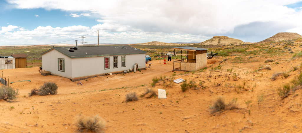
Like the Stephensons, many families in San Juan County, Utah and the Utah side of Navajo Nation — which borders four states — don’t have addresses. This makes getting help in an emergency challenging at best.
When asked how many buildings lack an address in Navajo Nation, MC Baldwin, the coordinator for the Navajo addressing initiative, said he can’t give an exact number. He estimates that there are about 10,000 “addressable structures,” which includes everything from homes, businesses, schools and government buildings.
People in Navajo Nation recall seeing homes go up in smoke long before a fire truck arrived; driving out to the highway to flag down ambulances; or getting in the car to race ailing friends or family to a doctor.
And the problem isn’t unique to Utah. Long wait times for ambulances are a problem across rural America: One study found average wait times are almost double in rural areas. According the last census, about 60 million people live in rural areas in the United States.
The health care coalition that encompasses San Juan County similarly has an average response time almost double the state average, and the delays can have serious consequences, according to Les Chatelain, director of emergency services programs at the University of Utah. In cases where an illness is “immediately life threatening, they’re never going to make it to the hospital in time,” said Chatelain.
Change may be imminent. The Navajo Addressing Authority and the Rural Utah Project, a nonprofit based in Salt Lake City, have been working to locate and give the people throughout the Utah portion of Navajo Nation a way to be found.
The Navajo Nation is providing families with the traditional addresses that are required for a slew of bureaucratic processes — from voting to registering for a driver’s license — and the Rural Utah Project’s work is making it easier to get directions to those homes.
It’s a monumental task, and progress is piecemeal. Soon, Rural Utah Project will deliver signs with geocodes that function as makeshift addresses to about 2,500 homes on the Utah side of Navajo Nation. It’s not a perfect fix, but more of a Band-Aid until a more permanent solution can be found, organizers said. And there is still a lot of work to do.
In the town of Aneth, Navajo Nation has finished naming the streets and assigning each home a proper address. Residents now have something to write when they go to the DMV, a location to give 911 if they have to call, and as Tara Benally, the field director of the nonprofit explained, something to “show that we still exist.”
A deadly oversight
The naming of streets and the numbering of homes was long overlooked in Navajo Nation due to jurisdictional issues that left land management and road maintenance in the hands of a dizzying number of government entities. The Navajo Nation is in charge of leasing land, but the Bureau of Indian Affairs creates the regulations that the nation enforces, according to a report by Michael Parish of the Diné Policy Institute.
Road development didn’t start in earnest until around 50 years ago. Some homes in the nation were built after dirt roads were put in; others have been there since before roads of any kind existed. Add the fact that the nation flows into three states, and assigning responsibility for addressing becomes even more confusing. The homes in Navajo Nation are also scattered across huge swaths of open land, making traditional municipal planning difficult.
The Rural Utah Project started working in San Juan County at the end of 2017 with the goal of increasing voter registration. According to TJ Ellerbeck, the group’s executive director, they’ve registered 1,600 voters, mostly Native Americans, in the county.
While registering voters, field workers for Rural Utah Project discovered that many indigenous people living in the Utah side of Navajo Nation were placed in the wrong voting districts because of their unconventional way of writing down addresses, which were more akin to directions than place names. In order to get people properly registered, they needed to provide more definitive addresses, and the project spun this process into a bigger program.

On the part of the Navajo Nation government, Baldwin has been working on getting signs on homes and streets since 2008, although the program predates his tenure.
Baldwin is the only employee currently doing field work, while the only other two Navajo Addressing Authority employees remain in the office at Window Rock, the capital of the Navajo Nation, which straddles the border of Arizona and New Mexico. The office was created as part of an Enhanced 911 Initiative, which included addressing every home in Navajo Nation.
Baldwin trains chapters — there are 110 making up the local governments in the nation — on how to address and provides technical support. That support includes using mapping software, putting up signs, and deciding on road names.
Baldwin describes the process of mapping using the analogy of a tree with a trunk and branches. First, they have to establish where the roads in a town are and name those roads. After they figure out the main highways and streets, they determine where side roads branch off and which side roads lead to homes.
The difficulties of navigating San Juan County are made especially clear after speaking with Pauline Trujeque, a UPS driver, on a sweltering afternoon.
Trujeque pulls out a small black spiral-bound notebook that serves as her GPS system. The edges are brown and the ink on some of the pages is fading. It’s a culmination of about 11 years of experience delivering mail in San Juan.
She started her route in 2008, and began taking notes immediately. The notebook is filled with maps, phone numbers and detailed notes on how to get to people’s homes — a name, the color of a house, and the miles it takes to drive there.
Trujeque guesses there are a few hundred entries, “but there could be so many more.” Many companies won’t ship to the makeshift addresses. “You ask a lot of questions, otherwise you’ll never find somebody,” she said.
Latitude and longitude
The process of mapping this rural landscape can be confusing unless you’ve visited the greater Four Corners region — the area that is Navajo Nation, the largest reservation in the United States, spanning 27,000 square miles.
Driving through Red Mesa, a chapter that dips into Utah and Arizona, the desert highway stretches out to the horizon. Miles of sagebrush and protracted dirt roads pass before the occasional house or pack of dogs materializes. The late-summer air is so dry and hot you begin to feel brittle. The heat, the stillness and the shades of burnt red, orange and pale yellow rock rising out of ankle-high grass all gesture toward the sacred.
The most southern parts of San Juan County feel untouched by time. Bluff, a small town that feels big compared to surrounding communities, begins and ends within four minutes of driving down U.S. Highway 191. The library is housed in a small square building that used to be the jail, the original signage intact: “San Juan County Jail. Dedicated to Justice. Obedience to Law Means Freedom.”
It’s in this remote landscape that Baldwin and the Rural Utah Project started teaming up about a year ago to locate homes using latitude and longitude rather than traditional addresses.
Specifically, they’re trying to get people to use “plus codes,” a kind of shorthand for coordinates on a map. When you receive a plus code for somewhere in San Juan County, it looks like this: “7CPX+PM Bluff, Utah.” That’s a shortened version of a full 10-digit code for a local hotel in Bluff, where many of the homes do have addresses, but the addresses don’t always work on popular GPS services.
If you enter the plus code in Google Maps, you see the full longitude and latitude displayed on the bottom of the screen. Just as every point in the world already has a latitude and longitude, every place also has a plus code. It’s just a matter of figuring out which points on a map have buildings on them, which of those buildings are homes, and what the plus codes are for those homes.
Each plus code is unique, and because it refers to a specific place on a map, there’s less room for confusion. There’s no question of which “Main Street” someone lives on. Once someone knows their plus code, they can text it to friends or family or read it out to a 911 dispatcher who can plug it into a GPS system.
The technology was developed by a Google team in Zurich led by Doug Rinckes, a technical program manager. Rinckes said he didn’t initially expect it to be used in the United States — previous projects were in Kolkata and Mogadishu, where many people’s access to basic services is limited because they don’t have addresses.
Rinckes was surprised when, after he gave a presentation on plus codes, he was approached by individuals in Navajo Nation, who explained they had huge swaths of unaddressed land.
“The example I was given right at the beginning was everybody knows somebody who’s died because an ambulance took too long to find their house,” said Rinckes.
While everything from voting rights to economic development can be improved by having an address, Rinckes stressed health care outcomes as a particularly important aspect. “Basically ambulances being able to drive directly to you and not get lost on the way.”
Rural Utah Project’s work during the past year has entailed figuring out which buildings in San Juan County were abandoned and which had people living in them, speaking to residents about getting an address, and now, providing those homes with signs that display their plus codes.

There were hurdles the Rural Utah Project didn’t expect, like the difficulty of explaining the GPS satellites that orbit the Earth to some of the elders on the reservation and translating that concept. In the Navajo language, things are described by what they do, explains Daylene Redhorse, 44, a field organizer for the project. The word satellite, roughly translated, would be “the metal box floating through the stars that takes pictures.”
“That sounds horrifying,” said Drew Cooper, the deputy director. It’s an ominous description. How does he explain this in a way that’s not creepy?
Cooper also explained that some residents feared the plus codes would be used against them. According to several sources, some Native Americans are targeted for predatory lending, and some worried that the plus codes would be given out to repossession agents. Field workers explained that plus codes were something people chose to give out — a way for others to find them only if they wanted to be found.
Collective memory
When Redhorse’s mom had a stroke, the family called 911, but no one on the line knew the roads or exactly where her family was located. They live in Tselaki Dezza, an area with 106 people, according to the last Census report, up a long dirt road that winds away from a paved highway. The family had to drive her mother to Blanding, where she was then flown to Farmington, New Mexico, because the closest hospital did not have equipment to treat a stroke victim.
An hour passed from the time she had a stroke to the time she was finally flown for treatment. With strokes, every moment that passes without treatment is critical, and the longer it takes to receive care the more brain damage occurs. Redhorse’s mother was unresponsive the whole time, ultimately losing mobility of her entire body and the ability to speak. She was 51, and after her stroke the family was told she only had six months to live. She passed away at age 57.
Kathy Carson, an EMT based in Bluff, said she often tells people to flash their porch lights on and off so she can locate their homes. Some people drive themselves to the fire station, have the ambulance meet them somewhere else, or sometimes even drive to Carson’s home, although she says the latter happens less often these days. “We don’t want to be that ambulance that keeps passing the burning house,” says Carson.
Carson has lived in Bluff for more than 40 years, and Dawn Dilego, a fellow EMT, has lived there for more than 20. They know homes by the families that live in them and Carson has an especially well-regarded map of the county inside her head, according to community members. The two know San Juan, but worry about what would happen if someone new to the area tried to take over their job. They wouldn’t know that five or so families might say their address is 10 miles past mile marker 5 on state Route 162. “New people coming in don’t have that collective memory,” explained Dilego.
Lynette Benally, an EMT for the Utah Navajo Health System, said she also frequently tells people to flash their house lights on and off and that family members usually run out to a place on the highway where an ambulance can see them.
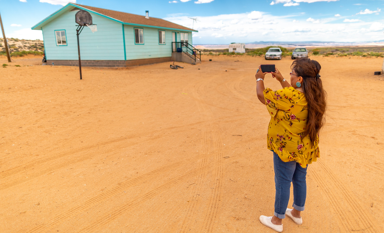
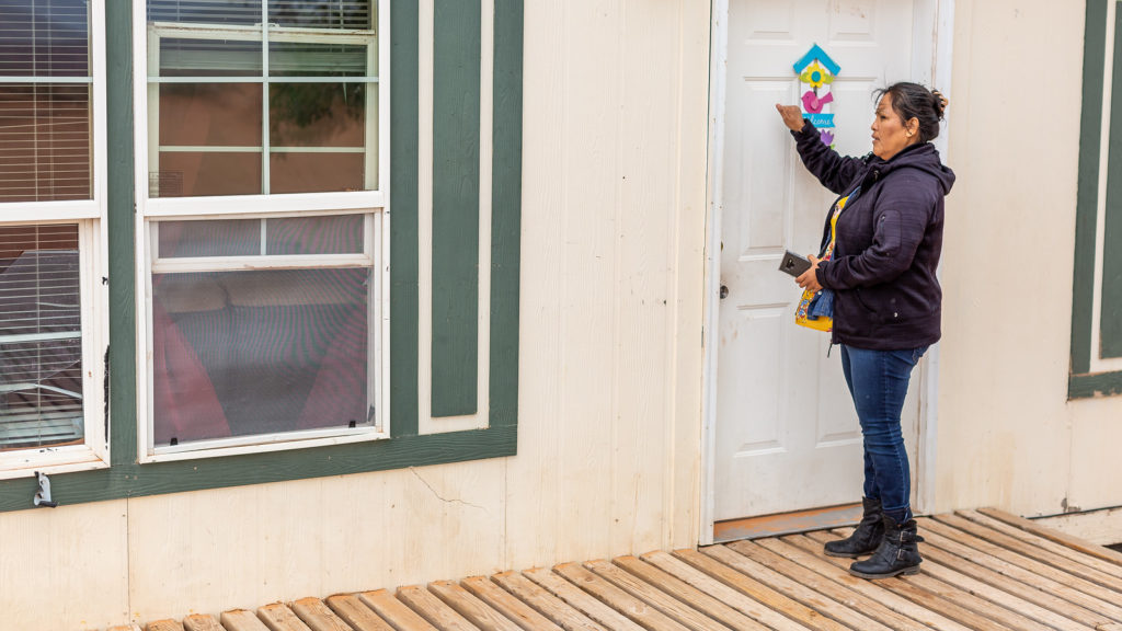
Tara Benally, Redhorse, and Marthleen Stephenson now work in the field for Rural Utah Project, taking photos of homes and structures, speaking to the people in San Juan County and explaining how plus codes work. Benally grew up in Navajo Nation and worked in construction. Redhorse was a teaching aid and Stephenson was a cook before she taught herself mapping software and started addressing for her local chapter before doing similar work for the Rural Utah Project.
They all had stories of loved ones and neighbors waiting for ambulances to reach their homes, a wait that sometimes had serious consequences.
Redhorse’s father is getting older, and she explained that he needed medical care at home after he started mixing up his medications, along with transport services to take him to dialysis appointments. It seemed like every week there would be a new driver, and every time they had difficulty finding him. “Giving out my dad’s address was pretty hard.” She would explain which county road they lived off, and that their home was at the end of it.
Tara Benally drives me to her mother, Mary’s, home on a Saturday afternoon. I want to ask her about her daughter’s work and what she thinks about the addressing program — the Benallys’ home is one of the many that were assigned plus codes over the past year.
Mary Benally’s home pops up out of the unbounded landscape. She, too, lives on a dirt road off a highway just past the Redhorses. She has about eight perfect, small watermelons growing in the yard. It’s almost a hundred degrees, and she complains that heat has made it almost impossible to keep her plants alive.
Mary Benally is either 68 or 72 — her father always claimed she was four years younger than the date the Bureau of Indian Affairs recorded. This doesn’t seem to bother her. Mary Benally is passionate, educated, both optimistic and shrewd — she recalls reading the encyclopedia as a child, anything that her parents brought home to her. She loved fairy tales, and when she got older she devoured Greek mythologies.
Will an address make a difference in Mary’s life? She doesn’t understand why people can’t find her house. Mary tells them how many miles her home is from the mile marker and which county road its on, but that still doesn’t suffice. She laughs that even her family can’t find it sometimes.
Things are changing though, and she sees the value that the plus codes had for registering voters. If an ambulance ever needs to be called, she’ll have a sign and a simple number, rather than a mile marker or highway number, to give 911.
She’ll have a way to be found and proof that she exists.